Author Archives: Alan Barlow

March 24th – Warm Weather!

Yesterday morning we were dropped off at Unicoi Gap and hiked 11.2 miles to Addis Gap, which was a tent site (no shelter). It was a very warm day yesterday (finally) and the first day that I have worn short pants. Our mileage has picked up the past 3 days and we are all pretty comfortable in the 11 mile range right now. Our trail family (tramily) has come together nicely as we all enjoy each others company and we all seem to be very compatible in our hiking abilities – I feel fortunate to have met Cobweb Rose, Snapshot and Mountain Crusher on this journey.

Todays hike was only 5.5 miles long but started out with a steep one mile climb with a thousand feet of elevation gain, an equally steep drop and then another mountain climb. At our camp site last night we met a young lady from South Africa who is hiking the trail alone. She had such bad blisters that she hiked today with pink flip flops and promptly earned the trail name of “Pink Flop”. I felt really sorry for her but she appeared to be a strong hiker and was not deterred by her present condition.

We had planned a short hike today so that we could go into the town of Hiawassee to resupply and pick up a few things at a local outfitter. We had a great lunch at a local cafe and I ordered a pizza from the hotel tonight while I did laundry and tried to stay off my legs a few hours. We will head back to the trail tomorrow around noon for a short 5 mile hike and then resume our normal schedule on Sunday.

(video)

March 22nd – Down Pour

I woke up this morning to a steady rain and tried to pack up my tent as quickly as possible. The past hours seemed to be a series of problems: I cut my thumb with my knife (not badly), the backup power bank for my phone, which I had just fully recharged the day before was completely drained, and the spot where I pitched my tent last night was not level and I slid off my sleeping pad throughout the night. So, the rain coming down seemed to be par for the course.

The trail conditions were very bad as the melting ground and ice created a massive mud pit almost the entire way. The video below provides a bit more info on that.

As today was supposed to be a low mileage day, I arrived at the shelter around 1:00 pm and it was almost full with people trying to get out of the rain and fix some lunch. A young man that I met a few days ago, ( Taylor, aka Snapshot) was also in the shelter and he was there with two other young hikers that he had connected with s couple of days ago – Mountain Crusher and Cobweb Rose. We were all soaked to the bone and, long story short, decided to hike another 2.5 miles to an area where we could catch a shuttle into the town of Helen and split two cheap hotel rooms. It was a long slog and slide down the mountain but in the end was well worth it as we all got hot showers, found a local laundry mat to wash and dry our clothes and found a local spot to have a hot meal. So, a great ending to an otherwise challenging day. Tomorrow morning we will catch a ride back to the trail head and continue on.

As we were coming down the last mountain in the mud today, Cobweb Rose suggested my trail name should be “Lucky” as I seemed to be the only one who was not slipping and sliding down the trail. So, I guess Lucky it is. 😊

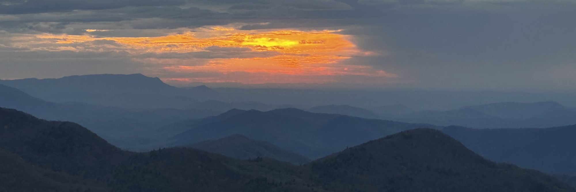
(Nature shots, Group shot – me (Lucky), Cobweb Rose (Emily), Mountain Crusher (Justin) and Snapdhot (Taylor), Brief video)

March 21st – Neel Gap to Low Gap

Today started with a shuttle ride from Hidden Pond Hostel to Neel Gap, which is where I finished yesterday. At the Mountain Crossing Outdoor Center I did a true weight check of my back pack which I have not been able to do up to this point. It was fully loaded with everything and I was afraid that it may be pushing 38-40 pounds, but I was pleasantly surprised that it was only 31 which I’m really pleased with. Hoping that when the weather warms up I can shed 3-4 pounds, but even at this point my body seems comfortable with the weight I am carrying and my shoulders no longer are sore after a day of hiking. Just before I started my hike this morning I received a call from my friend Doug Thomson, from my home town. Doug is one of the kindest, most helpful people you would ever want to meet (and so is his wife, Carolyn). Hearing his voice and infectious laugh was just what I needed to start my day. I also appreciate the positive words of encouragement and support that many of you have sent to me.

Today’s hike was my longest yet at 11.5 miles with a lot of hills and valleys. It was a good test to see how my body is adjusting and I was pleased to have completed today’s hike without any issues. Before leaving the hostel I weighed myself and I have lost 6 pounds during the first 5 days. So, this is not great and I need to up my calorie intake a bit more. And, I tried to do that at Tesnatee Gap where there were a couple of trail angels that had set up tables by the roadside and had a great lunch spread. It was incredible. The two people I met (King Tut & Sip – that’s their trail names) were doing so as part of Nudge Ministries. They were such kind people and a lot of fun to talk to.

The weather today was perfect for hiking and it should be warmer tonight – upper 20s, with increasing temps through the end of the week and mostly dry weather. I am back in my tent for the next few nights and I will scale back my mileage tomorrow to offset today’s higher mileage a bit and will start thinking about a day off sometime soon.

(King Tut & Sips, a few nature shots)

March 20th – Still Have My Shoes

It was 19 degrees at the drop off point this morning but there was a bright blue sky with plenty of sunshine. I ended up doing a “slack pack” day which means hiking with no pack or a pack with only minimal items needed for the day. The reason for this was that there is a 5 mile zone in my trail today where camping is only permitted if you have a bear canister. I opted to bring with me on this hike a bear bag because it’s easier to pack and is less weight than a canister. So, I had the choice today of hiking only a short distance and camping before the bear canister requirement zone, hiking a longer distance than I have planned to at this point, or hiking a full day today, getting picked up and staying at the Hidden Pond Hostel again tonight and then getting dropped off at Neel Gap and hiking beyond the restriction zone tomorrow. The last option is what I chose which meant I could leave 10 pounds of gear behind this morning, making the load I had to carry today much lighter.

Without question today’s hike was the most beautiful yet as I crossed over Blood Mountain, which is the highest peak in Georgia (4,458 feet). From the summit the sky was crystal clear and the view was beyond stunning. I think some places on this earth are so magnificent that you should have to encounter challenges and difficulties to see them. If you ever get a chance to hike Blood Mountain on a beautiful day – do not hesitate for one second to do it!

The hike down from Blood Mountain was pretty slippery as there was still ice on much of the trail and especially on the rocks where I had to step. There was one large rock formation where a very large bolder was perfectly balanced on the rock beneath it. It looked as though a strong puff of wind would be enough to make it tumble, but I’m sure it has been there for thousands and thousands of years. Nature is so amazing.

My hike ended at Neel Gap, which is the first waypoint on the northbound AT journey. There is a well known hiking outfitter store there called Mountain Crossing, and it’s the first resupply point for thru hikers to pickup food and supplies for the next few days. It’s also a famous location in that 10%-20% (not sure how solid this statistic is) of all Northbound AT thru hikers quit at this point in the journey, and many throw their shoes over the tree branches in front of Mountain Crossing. I texted my wife and told her that I would be leaving with my shoes on my feet!!!!

Sadly, a gentleman I met at the Amicalola Lodge, and who was on the same flight down to Atlanta from Boston, was coming out of Mountain Crossings just as I opened the door this afternoon. We took a few minutes to catch up on the past week and then he informed me that he was calling it quits and flying back to Boston tomorrow. Good job Johnny K and I wish you a safe trip home. Will miss seeing you on the trail!

Back to my tent for the next 2-3 days and then i hope to take a zero day in Hiawassee, GA.

Photos: Blood Mountain Shelter, Summit Blood Mtn, Lunch With A View, Balanced Rocks, History of Blood Mtn, The Quitting Tree, History of the AT in Georgia

March 19th – Tough 2 Days

I have had virtually no cell service since Thursday and am playing catch-up on the past few days. Posts for Thursday and Friday just went up.

When I got to my shelter Friday evening the skies opened up and the rain poured down as I was setting up my tent. Everything was completely soaked except my down quilt, sleeping pad and sleeping clothes which I keep in a plastic bag inside my pack for this very reason. Around mid-night there was basically a flash freeze and everything wet froze solid – the wet clothes hanging in my tent, my shoes which I left under the tent vestibule because they were so muddy, even the condensation in my tent had frozen on top of my down blanket, and of course, the tent was frozen inside and out. Because of the ice and the fact that I had no feeling in my fingers it took me 2.5 hours to get everything packed up and back on the trail. The hike on Saturday was actually very good, after I thawed out, and the scenery along the trail was beautiful. Roughly 30 minutes after leaving camp yesterday I was met by a group of “trail angels” from a local church who had an amazing spread of food and drinks that they had prepared just for hikers passing them. On the trail this is called “trail magic”. I had a hotdog, banana and a piece of bubble gum. Then, just before noon, at another trail crossing a group of former AT hikers were serving hot grilled cheese sandwiches from the back of a grill on their truck. Delicious! Can’t thank these kind and generous people enough for their hospitality and generosity.

The shelter location I camped at last night was not as crowded as Friday night as a lot of people went off trail due to the weather forecasted for last night – extreme cold. I tried to do the same but had no luck finding a vacant hostel. So, before going to bed I put on 4 shirts, my down jacket, one pair of wool long johns, my hiking pants, 3 pairs of socks and a toboggan. The actual temperature dropped to 17 degrees and the wind howled all night long. It was after 4:30 this morning before I actually fell asleep. But, I did stay warm and that was the most important goal. This morning I left camp around 8:45 and it was a really beautiful but cold hike. Some of the views were just stunning and at one stop it was barely possible to see some of the Atlanta skyline some 70+ miles away. I came off trail at the completion of my hike where I was met by the owner of the hostel I am staying at tonight which is just a little over a mile from the trail. I got a shower, shaved, got my clothes washed and have picked up a few snacks since typing this blog. I will be in a small bunkhouse tonight with 7 other hikers. The Hidden Pond hostel is very quaint and the owners, Johnny & Rainbow, who hiked the AT last year, really know how to treat their guests. And, their dog Sam makes us all feel right at home. I will return to the trail tomorrow morning and go a few more days before I take a “zero” day (no hiking that day). My goal to start with has been roughly 8 miles each day for the first week and then increasing by a mile or so each week thereafter with a day off every 7 or 8 days depending on what accommodations are available. Physically, my body has had no issues which I am grateful for. There are two people here at the hostel who are already injured and trying to figure out what to do next. I will say that the extreme cold here is not what I had expected. While the forecast for the next few days is dry, the cold weather seems to be hanging on. Spring will be here soon though. I’m not sure when my next opportunity will be to post another blog but will do so as soon as I can

In closing I would like to wish Carl Holder, and his new wife Sarah, a big CONGRATULATIONS on the occasion of their wedding yesterday in Annapolis, MD!

March 16th – Springer Mountain

My hike today began at the top of Amicalola Falls with my wife and daughters dropping me off and making their way to Atlanta. It was a quick goodbye and in the blink of an eye my journey was underway. I hiked the approach trail to Springer Mt which is 8.9 miles long and is not part of the AT. The trail conservation guides told me yesterday that the approach trail would be difficult but that my hike the following day would be much easier. While the hike today had several steep sections I did not think it was too difficult. It was a beautiful day but chilly. There really were not a lot of pictures to be taken today as I was mostly in the woods without too many views. The trail was well marked and no signs of trash or anything else that people could leave behind. I did find myself having to look down frequently as the trail was littered with rocks and tree roots. The official start of the AT is a simple bronze plaque affixed to a rock – it would actually be very easy to walk by and not even notice if you weren’t looking for it. I am camping tonight at the Springer Mountain shelter at a nearby tent site along with a few other hikers whom I have had a chance to talk to. Everyone has been very friendly and helpful. The forecast for tonight is for rain to move in with heavy rain and cool temperatures tomorrow.

March 15th – The Journey Has Begun

After many months of preparing to hike the Appalachian Trail, the time has finally arrived. Yesterday my family and I departed Boston, in the middle of a strong Nor’easter and flew to Atlanta. From there we drove to Amicalola Lodge in Northern Georgia where we spent last night and will stay tonight. The lodge is beautiful with amazing views of the surrounding mountains. This morning we made a quick trip to the nearest Walmart where I picked up the food I will need for the next 4 days. After lunch I registered my hike at the AT Conservancy office and attended a brief orientation session which basically focused on two topics – how to manage your human and non-human waste while on the trail. No, this will not be a 5 star accommodation rating experience!

Following the orientation my family and I hiked the lower falls portion of the 8.9 mile approach trail to Springer Mountain, which is the southern terminus of the AT. The falls were beautiful but it was a steep climb and I was very glad not to have my backpack on. Tomorrow morning my family will drop me off at the top of the falls where we stopped today. They will make their way back to Atlanta to catch a plane to Boston and I will finish the approach trail to Springer Mountain and begin my hike on the official AT route Friday morning.

I cannot express enough my appreciation to Diane, Stephanie and Courtney for supporting me and joining in at the start of this journey. I will miss them more than words can express over the coming months.

Thanks for following along as I make my way north to Mt Katahdin, Maine.